INSAT-3DR Satellite Monitors Extensive Cloud Cover Over India
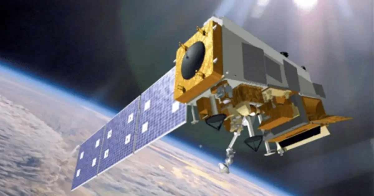
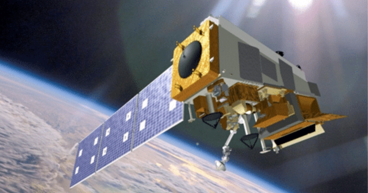
Recent analysis of visible satellite imagery and INSAT-3DR infrared images indicated that nearly 60–70% of India's landmass was under cloud cover. INSAT-3DR is one of India's most advanced meteorological satellites, playing a crucial role in weather forecasting, cyclone monitoring, disaster management, and environmental observation.
INSAT-3DR Imagery Shows Two-Thirds of India Under Cloud Cover: A Monsoon Snapshot and a Look at India's Meteorological Eye in the Sky
An analysis of visible satellite imagery combined with infrared observations from the INSAT-3DR weather satellite has found that roughly 60 to 70 per cent of India's land area was covered by clouds on 19 July, with the densest cloud formations concentrated over the northern plains, extending from Punjab through Uttar Pradesh, Bihar and West Bengal, as well as across much of the Northeast. Long bands of monsoon cloud were also observed spreading over peninsular India, sustained by moisture-laden winds from the Arabian Sea, while western Rajasthan and parts of Tamil Nadu remained comparatively clear.
"The estimate represents a snapshot in time, with cloud cover naturally changing throughout the day as weather systems develop and dissipate."
The reading marked a revival of monsoon activity after a seasonal lull, and subsequent satellite passes tracked the system intensifying further: by 21 July, INSAT-3DR and INSAT-3DS imagery read by the India Meteorological Department showed cloud cover pushing past 70 per cent of the country, with Cloud Top Brightness Temperature readings over the Bay of Bengal, Odisha, and West Bengal dropping to between minus 60 and minus 80 degrees Celsius, indicating storm towers punching 12 to 16 kilometres into the atmosphere. By 22 July, fresh imagery had captured close to 95 percent of the subcontinent blanketed in cloud, a scale of coverage that meteorologists described as extraordinary even by monsoon standards. This satellite-driven tracking of monsoon intensity brings renewed attention to the spacecraft doing the observing.
INSAT-3DR: India's Advanced Meteorological Eye
INSAT-3DR, or Indian National Satellite-3D Repeat, is an advanced meteorological satellite developed by the Indian Space Research Organisation to improve weather forecasting, cyclone tracking, disaster warning, and environmental monitoring over India and the surrounding region. It was launched on 8 September 2016 aboard the GSLV-F05 launch vehicle from the Satish Dhawan Space Centre in Sriharikota, a mission notable in its own right since it was the first operational GSLV flight to carry an indigenously developed cryogenic upper stage.
"The satellite carries a multispectral imager and atmospheric sounder to support meteorological observations over the Indian region."
The spacecraft is configured with two principal payloads, an Imaging System and an Atmospheric Sounder, and like its predecessor INSAT-3D, it also carries a Data Relay Transponder and a Search and Rescue Transponder, allowing it to support both weather monitoring and emergency response services for users ranging from the Indian Coast Guard to shipping and defence services. Positioned in a geostationary orbit at 74 degrees East longitude, roughly 36,000 kilometres above the equator, INSAT-3DR provides continuous, half-hourly multispectral imagery over the Indian region, giving forecasters a near-real-time view of evolving weather systems.
Technical Improvements Over Earlier Missions
INSAT-3DR incorporated several significant upgrades over its predecessor INSAT-3D. It introduced imaging in the middle infrared band, enabling night-time pictures of low clouds and fog that earlier satellites could not capture after dark. It added imaging in two thermal infrared bands, improving the accuracy of Sea Surface Temperature estimation, a parameter critical for cyclone genesis forecasting in the Bay of Bengal and Arabian Sea. It also delivered higher spatial resolution in both the visible and thermal infrared bands, sharpening the detail available to meteorologists.
"The visible imaging channel functions like a conventional camera, recording sunlight reflected from cloud formations, while the thermal infrared channel measures heat emitted at 10.8 micrometres, allowing observations both during the day and at night."
This dual-channel approach is what allows analysts to distinguish between merely widespread cloud cover and genuinely intense convective activity. Cloud Top Brightness Temperature, derived from the infrared channel, indicates how high a cloud has grown, since air in the troposphere cools with altitude; a colder reading signals a taller, more energetic storm tower capable of producing heavy rainfall and severe weather, rather than a shallow, steadier cloud bank.
Significance and the Way Forward
The significance of this capability extends well beyond a single week's monsoon update. INSAT-3DR's continuous, half-hourly geostationary coverage gives the India Meteorological Department the ability to track the day-to-day pulse of the southwest monsoon, distinguish weak spells from genuine revivals, and issue early warnings for heavy rainfall, thunderstorms, and cyclones with a lead time that ground-based observation alone cannot match. Its search and rescue payload additionally extends this utility into humanitarian response, supporting maritime and disaster-relief operations across the wider Indian Ocean region.
Looking ahead, INSAT-3DR now operates alongside its successor, INSAT-3DS, launched in February 2024, and the two satellites together are expected to sustain and eventually extend India's meteorological satellite coverage as INSAT-3DR approaches the latter years of its planned service life. The continuity of this constellation, along with ongoing efforts to validate and refine cloud-cover and sea-surface-temperature retrievals using machine-learning approaches, will be central to strengthening India's monsoon forecasting and disaster preparedness in the years ahead.
Conclusion
The recent satellite readings showing 60 to 70 percent, and later near-total, cloud cover over India illustrate both the dynamism of the southwest monsoon and the quiet but indispensable role played by INSAT-3DR in monitoring it. Nearly a decade after its launch, the satellite continues to be the primary geostationary instrument through which India observes, measures, and anticipates the moods of its most consequential seasonal weather system.